
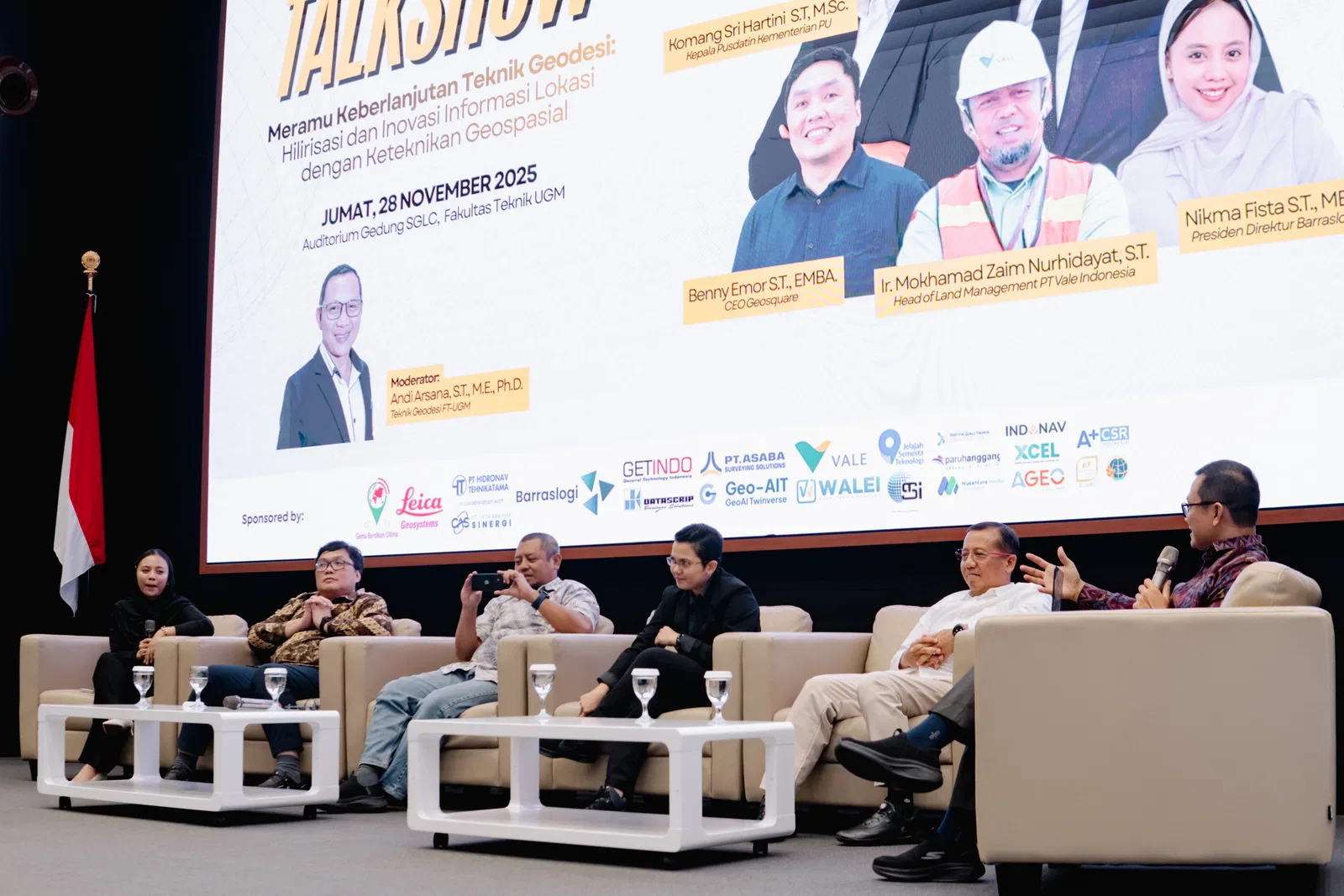
Yogyakarta, 28 November 2025 — Keluarga Alumni Teknik Geodesi (Katdesi) of the Department of Geodetic Engineering at Universitas Gadjah Mada hosted the Talkshow Katdesi UGM 2025 themed “Meramu Keberlanjutan Teknik Geodesi: Hilirisasi dan Inovasi Informasi Lokasi dengan Keteknikan Geospasial” as part of the alumni reunion programme. The event brought together students, alumni, and geospatial professionals to explore how the downstreaming (hilirisasi) of geospatial data is becoming increasingly essential, and how geodetic engineers must evolve alongside it.
Diverse Lineup of Speakers
The panel featured alumni of UGM’s Geodetic Engineering programme as well as industry leaders, each representing a different branch of the geospatial world:
Dwi Budi Martono, IT Expert Staff, Ministry of Agrarian Affairs and Spatial Planning/National Land Agency
Komang Sri Hartini, Director of Data and Information Technology, Ministry of Public Works
Mokhamad Zaim Nurhidayat, Head of Land Management at PT Vale Indonesia
Nikma Fista Safrina, President Director of Barraslogi
Benny R. Emor, CEO and Co-founder of GeoSquare.ai
The Auditorium of The Smart and Green Learning Center of the Faculty of Engineering was packed with enthusiasm from start to finish. The gathering of experts from diverse geospatial fields offered students and professionals a glimpse into future opportunities, unified by a compelling message: a degree in Geodetic Engineering opens many doors.
Our CEO’s Take on Data Downstreaming, and How the Possibilities are Limitless
One of the key moments of the talk show came from Benny Emor, who presented a unique analogy that resonated with students.
“Spatial data is just like genres of music and movies. The thematic ideas are endless. What matters is whether we create the ecosystem that allows those ideas to flourish.”
Emor explained how GeoSquare.ai has been working to “downstream” spatial data—transforming raw datasets into accessible, functional insights. Much like the creative economies behind film and music, Indonesia’s geospatial sector could unlock innovation and economic value if a strong supporting ecosystem is built.
He showcased how spatial datasets can recombine into new “genres” such as land valuation, hazard intelligence, mobility analytics, business scoring, and more.
“If the data foundation exists,” he added, “then the creativity of the next generation—your generation—will define the rest.”
Resonance with Fellow Speakers
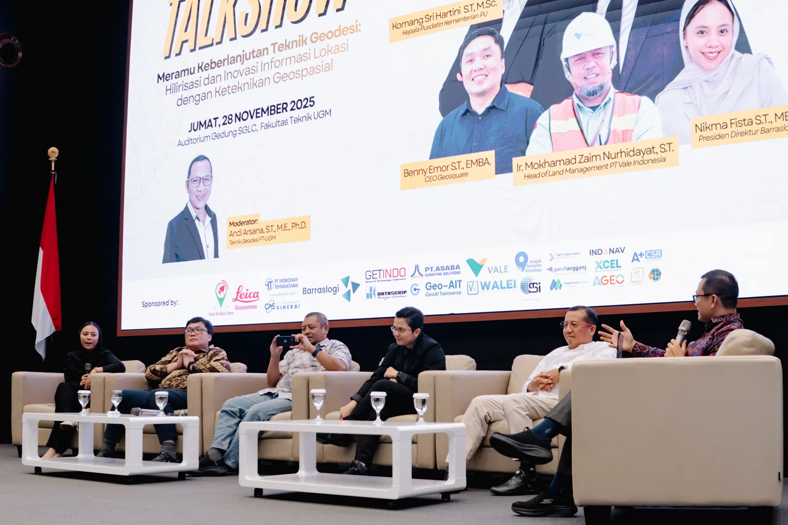
Each speaker aligned their message with the theme of geospatial downstreaming, offering perspectives shaped by their respective industries.
• Nikma Fista Safrina — The Rise of the “Alpha Geodet.”
Safrina highlighted how geodetic graduates must increasingly become strategists, not just data collectors. She emphasised the shift toward integrated, insight-driven decision-making.
“A discussion with a client made me realise that without a spatial perspective, integrating human-related data becomes difficult. This is why strategic skills like decision-making, influence, people management, policy, and compliance should be part of Alpha Geodet.”
• Komang Sri Hartini — Geodesy as the Backbone of Modern Construction.
Hartini discussed how geospatial technology underpins Indonesia’s construction modernisation, supported by a state budget of 110 trillion Rupiah. BIM, IoT, mobile collaboration, prefabrication, and 3D scanning are increasingly central to national projects.
She noted that these technologies rely on a collaborative environment led by the Geospatial Information Agency (BIG).
“Without accurate geoprocessed 3D models, the IKN (Indonesia’s new capital, Ibu Kota Nusantara) project would not have reached 75% completion last year.”
• Mokhamad Zaim Nurhidayat — Eco-Sociospatial Thinking for Sustainable Industries.
Nurhidayat introduced the eco-sociospatial path within data downstreaming, an approach that ensures land and space generate both ecological and social benefits. He highlighted the rising importance of the mining and forestry sectors, especially with carbon monetisation now valued at 40 trillion Rupiah annually.
“In mining and environmental management, we need a sustainability-based approach. Geospatial perspective is the core, and for data downstreaming, this is one of its key paths.”
• Dwi Budi Martono — Downstreaming Cadastral Data for Economic Growth.
Martono highlighted how data downstreaming applies directly to the cadastral sector, where land registration and property information can be transformed into geospatial products that support national economic activity. He pointed to banking as one example, where property valuation informs credit decisions, noting that the themes available for downstreaming are “as unlimited as songs,” echoing Emor’s earlier analogy. Martono also reinforced Safrina’s message on the Alpha Geodet, emphasising that data downstreaming is seen as an opportunity that requires graduates to stay adaptable and equipped with broader strategic skills as the geospatial market continues to evolve.
“If your map, your cadastre, is good, that is when it creates the potential for information that can be sold by Alpha-Geodets as entrepreneurs in the geospatial field.”
An Auditorium of Curiosity
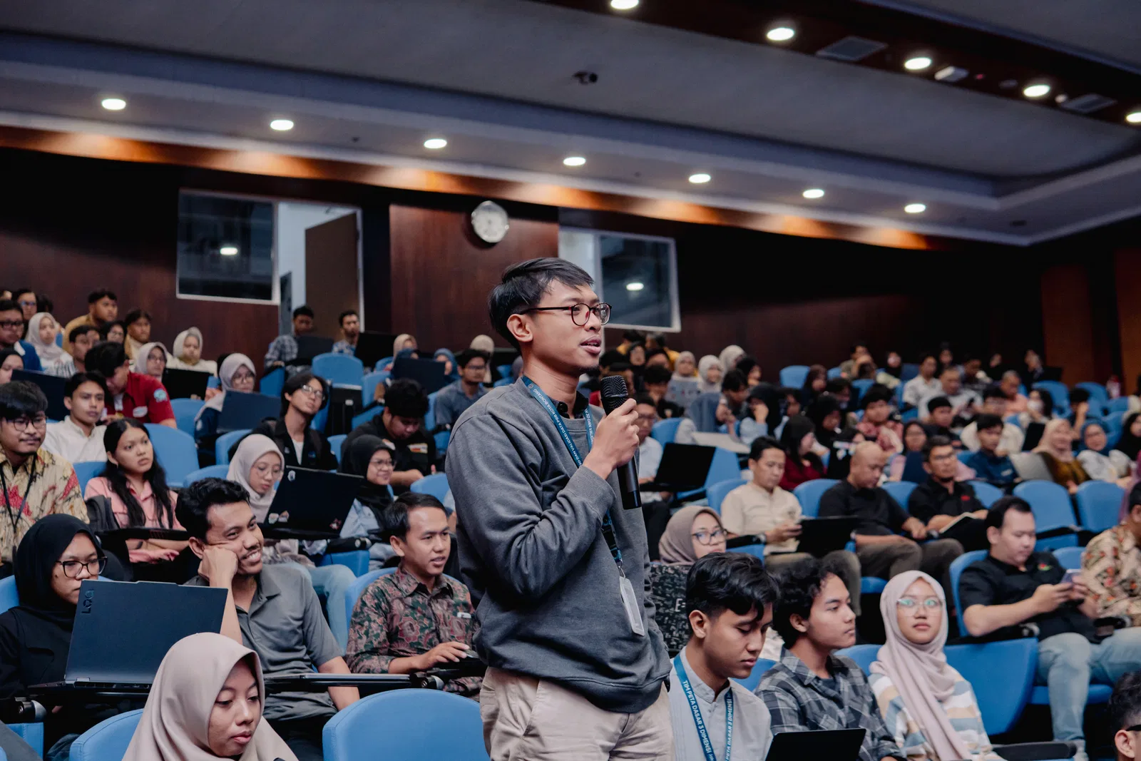
The talk show highlighted that the geospatial field is no longer confined to traditional surveying roles. Instead, graduates now find themselves working at the intersections of policy and regulation, environmental and land management, logistics and supply chain optimizations, and tech innovation entrepreneurship. This message strongly resonated with the student audience, who came ready with questions. Among the most popular were:
“What makes Geodetic Engineering different from Geography?”
“How does land clearing and management progress in the mining industry? Especially considering its connection to forestry?”
“How is the implementation of carbon credits progressing in Indonesia?”
Each speaker offered candid reflections and practical advice, experience-driven insights, helping students understand how geospatial knowledge applies across disciplines, industries, and government roles.
A Bridge Between Generations
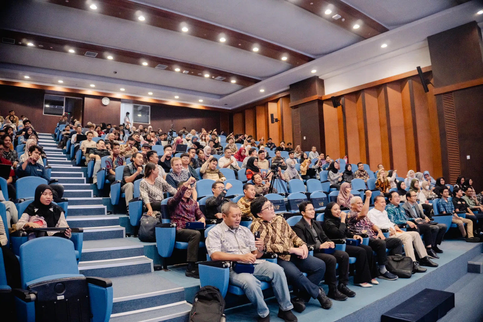
The event created a warm and lively atmosphere as alumni shared their journeys, government leaders offered insights on national priorities, and private-sector professionals opened windows into industry challenges.
For many students, the biggest takeaway was reassurance: Geodetic Engineering is a gateway, not a constraint. The discipline’s strength lies in its ability to connect computation, location, engineering, and real-world impact. Along with that message, speakers emphasized the emerging wave of data downstreaming as a concept that opens new, often hidden opportunities across industries. To thrive in that landscape, Alpha-Geodets are encouraged to seize these opportunities early—equipping themselves with the skills and mindset needed to support the growing ecosystem that will shape Indonesia’s next phase of economic development.
Watch the Full Talkshow
Readers who want to revisit the complete discussion or dive deeper into each speaker’s session can watch the full recording here:
👉 https://www.youtube.com/live/DFqGvi0W1bM?si=Cg7P1HUggsjhCbsO