Solar Site Suitability
RURAL USE CASES • RENEWABLE ENERGY INFRASTRUCTURE
SOLAR PANEL SITE SUITABILITY
Identifies high-potential solar deployment areas, revealing locations that combine strong energy yield with proximity to demand and existing infrastructure. This map-based analysis helps prioritize sites that balance technical feasibility, grid relevance, and real-world usage signals for efficient solar investment decisions.
PLTS Suitability Heatmap (CARTO / OpenStreetMap Basemap)INDONESIA REGIONAL GRID
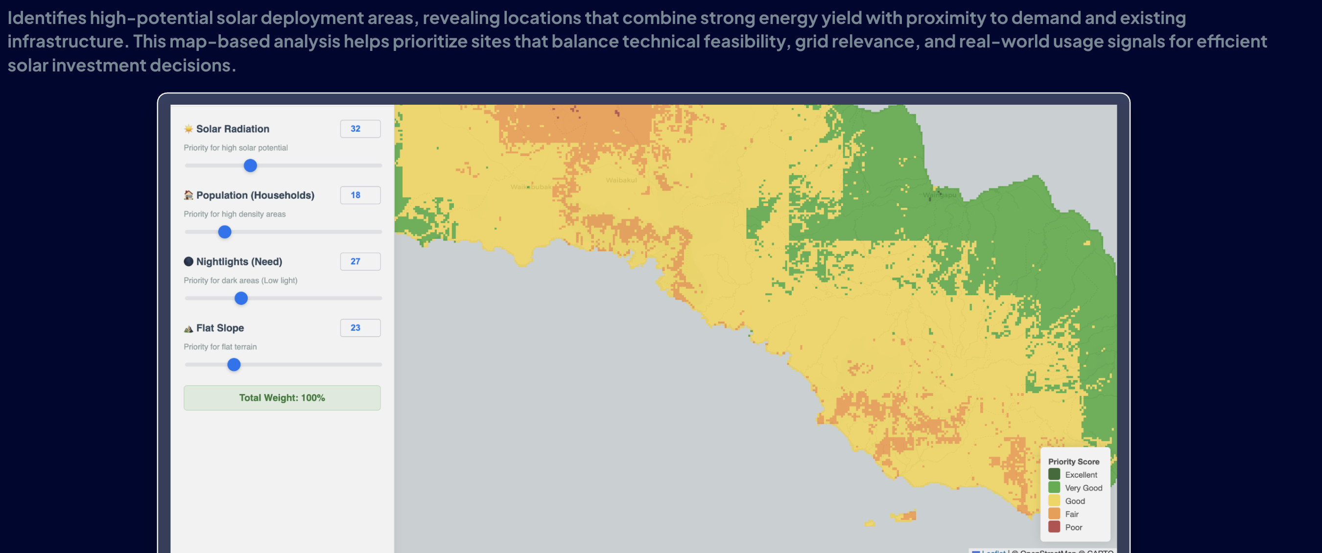
Priority Score: Excellent Very Good Good Poor
© OpenStreetMap © CARTO
4 Core Analysis LayersALL ACTIVE
Solar RadiationGHI > 4.8
Global Horizontal Irradiance yield modeling per km².
Population (Households)DEMAND
Proximity to rural grid consumption nodes and households.
Nightlights (Need)ELECTRIFICATION
VIIRS satellite radiance measuring underserved communities.
Flat SlopeSLOPE < 5°
Digital Elevation Model (DEM) slope to reduce civil earthwork cost.
IPP & UTILITY BENEFIT
Accelerate Solar Farm Bankability
GeoSquare eliminates speculative land scouting, cutting feasibility study lead times from 6 months down to under 48 hours.
REQUEST PLTS FEASIBILITY REPORTenter the future
Others build platforms.
We build the brain.
Schedule a confidential consultation with our spatial data team or request sample reports to evaluate precision location intelligence first-hand.
Legal EntityPT Geo Inovasi Nusantara
Direct Inquiriescontact@geosquare.ai
HeadquartersJakarta, Indonesia